Research

Topic 02

Disturbance and Resilience

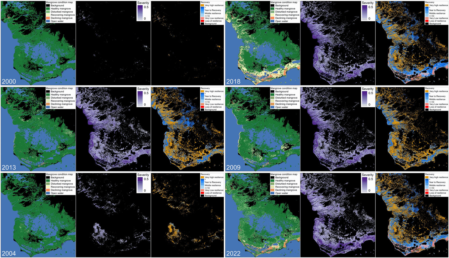
I use dense satellite time series to study disturbance and recovery as one process: when damage happens, how fast ecosystems recover, and whether another event arrives before recovery is complete.

We applied this idea to Florida mangroves, where repeated hurricanes can shrink the recovery window and push damaged forests toward ghost forest or open-water transitions. I also use temporal autocorrelation (AC1/TAC1) as a separate indicator of resilience, especially for detecting weakening recovery capacity.

Selected papers

Model

Media

Animated resilience and recovery analysis from satellite time series.
Continuous monitoring of mangrove condition, disturbance severity, and recovery.
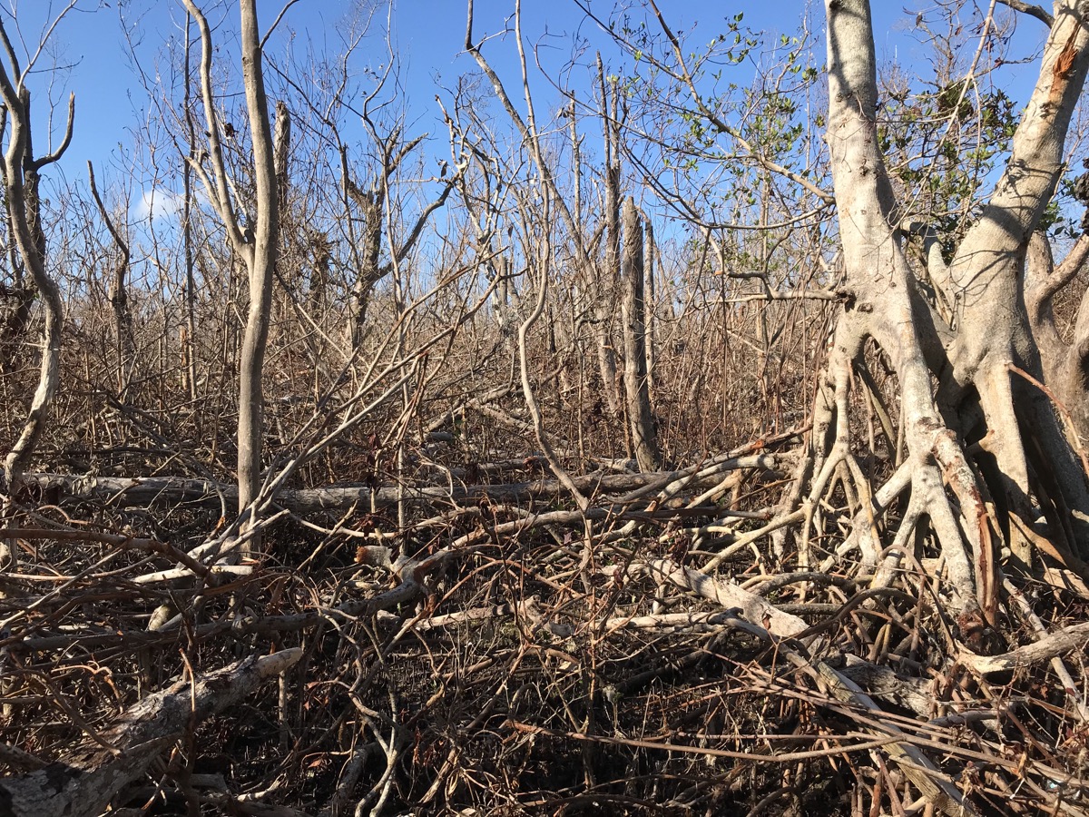
Field view of hurricane-disturbed mangroves in Florida.
Field view of disturbed mangrove structure.
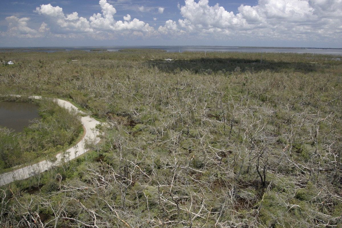
Aerial view of hurricane-impacted mangrove canopy in Florida.
Aerial view of hurricane-impacted mangrove canopy.

Topic 03

Dense Time Series for Land Surface Monitoring

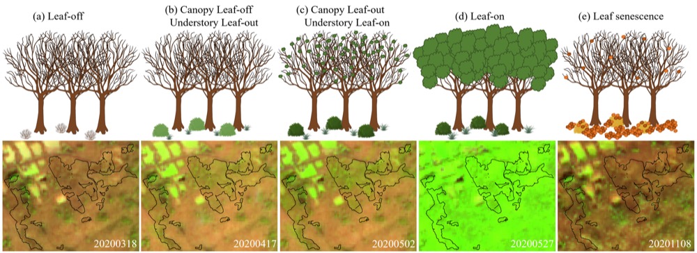
Dense satellite time series make some hidden land-surface features visible because timing can carry information that a single image cannot. Instead of depending on one clear image, this work uses seasonality and short-lived phenological windows.

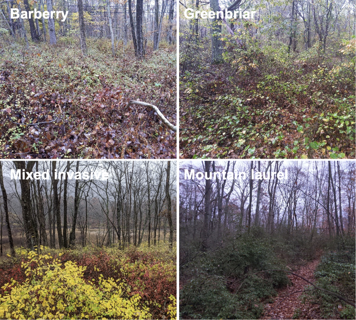
Understory vegetation is a good example. It is usually hidden by the forest canopy, but an early-spring window before canopy closure lets Sentinel-2 time series detect understory plant communities.

Selected papers

Code and product

Media

Understory seasonal phenology and Sentinel-2 time series figure.
Understory phenology as a time-series signal beneath deciduous forest canopy in early spring.
Field photos of understory plant communities including barberry, greenbriar, mixed invasive plants, and mountain laurel.
Field examples of understory plant communities.

Topic 04

Water Dynamics

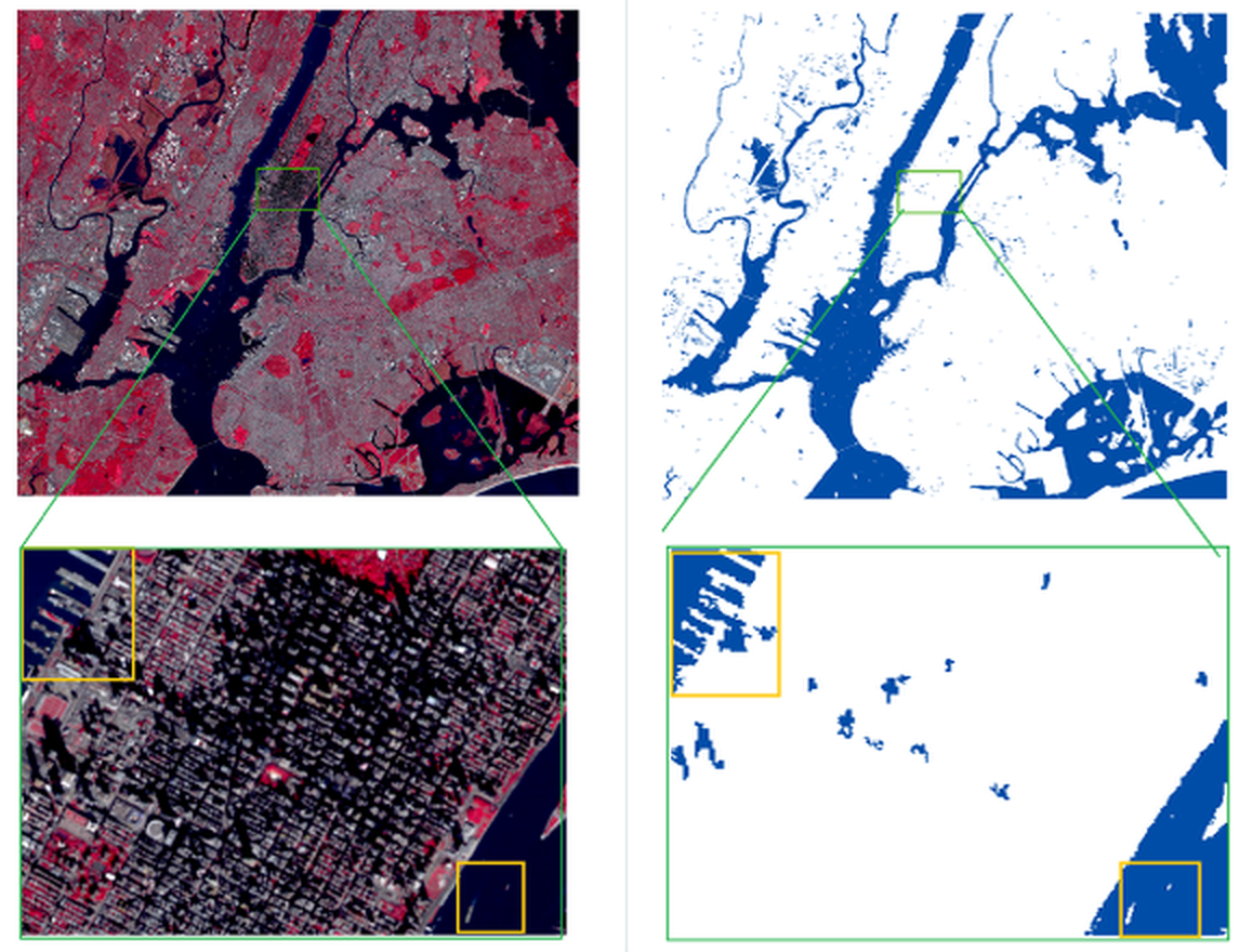
I developed image-processing methods for automated surface-water mapping. This work handles common errors in optical water detection, especially confusion with built-up surfaces and terrain or cloud shadows.

With Sentinel-2 and Landsat observations, these studies improve water-index design, reduce urban background noise, and map monthly surface-water extent at 10 m resolution.

Selected papers

Product

Surface-water detection example showing built-up noise suppression.
Surface-water detection with built-up noise suppression.

Topic 05

VHR Image and 3D Modeling

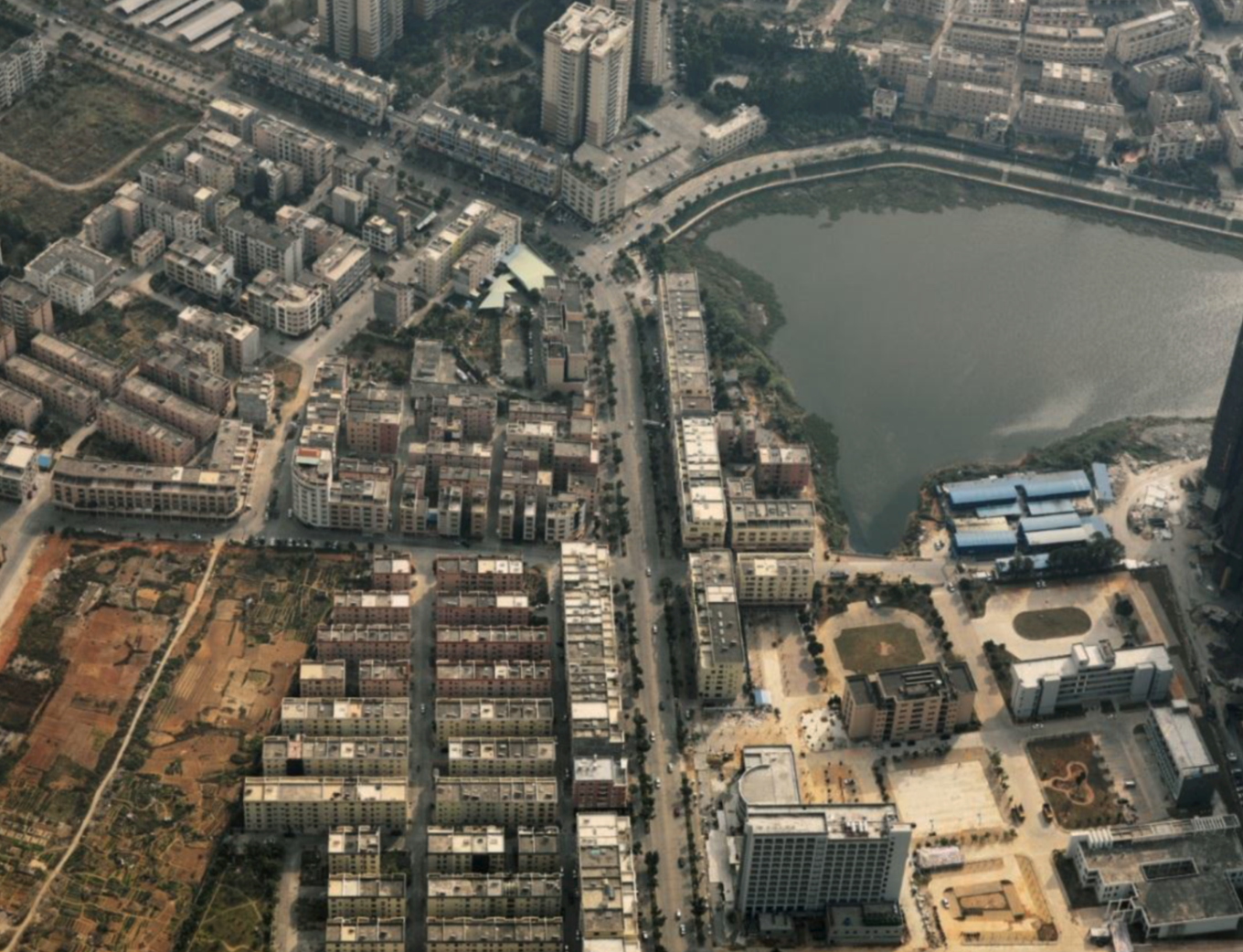
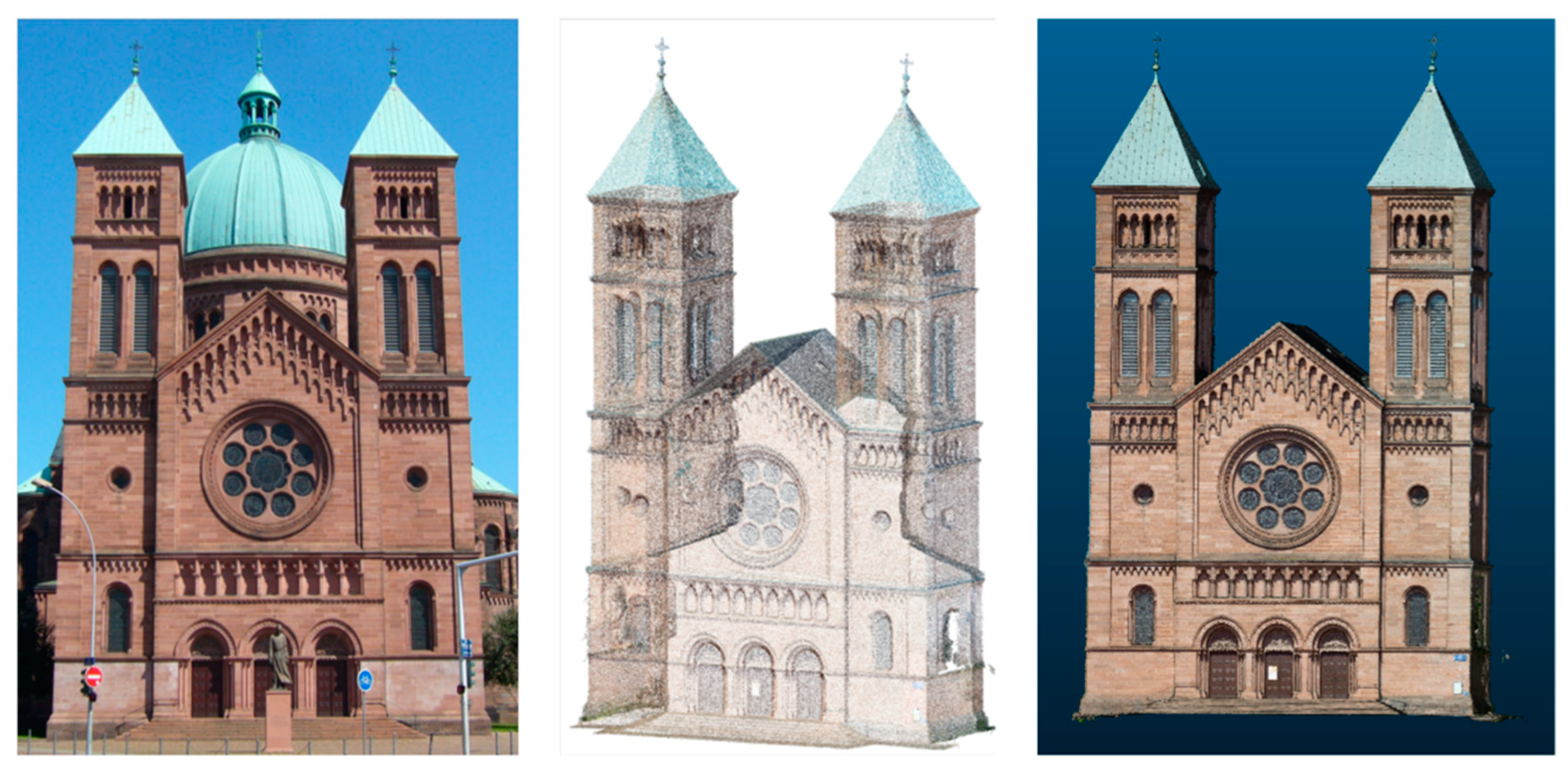
My earlier work used VHR oblique aerial imagery for urban image matching and building extraction, and photogrammetry for built-heritage documentation. It connects geometric image interpretation with practical reconstruction workflows.

Selected papers

VHR oblique aerial imagery for urban building analysis.
Photogrammetry point cloud and built-heritage documentation.